Alpe D'Huez

Alpe D'Huez

Training in the Lakes

Training in the Lakes
Pain on Newlands Pass

Sunday 19 December 2010

Snow, Cold Feet and Utag (s)

As the bad weather continues the and the chances of going out on the bikes is, frankly nil, I thought that I would tell you about a few products that I have found useful.
I have always had cold feet on the bike, even in summer, and I have tried everything to try and counteract and I have finally found somethings that help.

Firstly, there are Mycoal instant foot warmers , which my wife swears by and stick onto your sock, just under your toes and keep them warm for hours - good value too as you will see if you click the link.

Secondly, having read various forums, I decided to change saddles. I don't know whether it's just my shape but none of the Bontrager seats that I have come across are comfortable for me, so I decided to get fitted up for a Specialized Toupe Team BG (Body Geometry) 130mm saddle. Getting measured up was far less intimate than I had thought (you sit on a gel pad and the impression left by your sit bones is measured), but from the moment I I started using it, I could not believe how comfortable it was. Not only that, but the centre of the seat (running along the length) has a groove missing which is said to remove pressure on your femoral arteries allowing more blood to pass down your legs and to your feet. It has certainly worked wonders for me.
The second thing I would like to share is the UTAG, which I have no qualms about promoting to the full, as I have one myself, and I have bought one for Amanda, my Dad and John (my wife's Dad who has vascular dementia).
They are essentially a USB stick that you can have all your personal details on including Blood Group, Medication, Allergies etc. You can add a photo of yourself for recognition and it even has a password protected area where you can put scans of important documents that only you can see.
They come in a wrist band version (Black, Blue or Pink)  UTAG DIGITAL USB SPORTS BLUE WRIST BAND SMALL (BLISTER PACK) ,  which myself and Amanda have, a dogtag version,  UTAG In Case of Emergency USB Dogtag (which my Dad has) and a wallet version which is what John has,  UTAG Ice Card- Usb Safety Information card . Click these link to see them at Amazon. They are also sold by http://www.inmotionproducts.com/ in the U.K

The Wrist Version - also available in Pink
I originally got one because I cycle to work very early in the morning and wanted the assurance that if I had an accident an ambulance crew could find out all about me quickly (all ambulances have the facilities to read the UTAG). My Dad is a keen walker so the reasons were similar, but in the case of John, the reasons were slightly different. John has become anxious and concerned that his vascular dementia may cause him to not be able to explain who he is to people and the worry has increased that he may become lost and not be able to explain to someone who he was or where he lives.
His UTAG wallet card contains all this information as well as details of his condition and medication, and gives him some peace of mind when he is out and about, and he not mentioned this concern since.

Please note if you do purchase any of the items linked from anywhere on this page I will put the monies raised into the charities that I am riding for.

Thanks in advance

Sunday 12 December 2010

Hampshire Hilly Hundred - In December - Alone .........Why???

With all the bad weather that we have been having of late, the "big thaw" (has there ever been an average sized thaw??) is now in full swing, and I thought that it would be good to get out and really shake up my limbs.

I had the idea that I would do the Hampshire Hilly Hundred (normally done in May) route as I already had it in my Garmin Oregon 300 GPS, so I didn't have to do too much planning.

On the Saturday morning, I dragged myself (silently kicking and screaming) to get ready and although the freezing temperatures of recent days had gone, a grey sky loomed overhead. Not the end of the world as I have plenty of kit to keep me warm, but it left me with the common cycling problem of how much to wear so that you are warm enough, but not overly warm when you are climbing. Worse still - the Madone was in the corner looking at me and wanting to go out - really wanted to take him but decided not to because I didn't want to cover him in salt and mud.
So at 8.45am I set out on the Trek 1.2, complete with mud guards, two spare tubes and enough cereal bars to feed a small army and headed for Twyford which is the closest point to the route.

My support vehicle had decided not to join me and instead, headed for equally testing (so she keeps telling me) Gunwharf Quays for a day a of Christmas shopping - hardship indeed....

As I turned right off Hazeley Road, onto Mere Lane I come across Whites Hill, which is a nasty short hill with 17% gradient at one point. It's a road I know very well but was a bit slippy on this occasion, as water ran down the surface. Once safely negotiated, I turned through Owslebury and then right towards Corhampton Golf Course which I was surprised to see was still covered in snow with little sign of thawing.

The route then turns towards Broxbridge and on to the Bat and Ball Pub which signals the start of the climb up Old Winchester Hill, which although one of the highest points in the area,  is not a difficult climb at all from this direction (there are four other routes to the top all of which are tougher). Halfway up though, the bike seemed to be slow and heavy, and I was convinced that I had a puncture - this was a prelude to me hitting what was not "the wall" but was more of a waist high picket fence. I had eaten and drunk plenty but the cold conditions were sapping the strength from my legs and looking skywards, there was no sign that the sun was going to able to get through the cloud. Still, I kept going over the top and descended towards West Meon and over the main A32 and on towards the lovely village of Exton.
The route goes around the edge of Exton as this takes you to the bottom of Beacon Hill and it is the most testing climb in the area in my opinion, as it is fairly steep but also is long enough to mean that you cannot simply overpower it - you have to think your strategy a bit to climb it well.
At the top, fairly tired but pleased with my efforts I saw something that I had to stop and admire - a Red Kite, still fairly rare in England circling low almost directly over my head.


He/she circled around for three minutes or so, then shot down behind the hedge and rose back up with a small kill in its' claws - truly awesome.

The next stretch of the ride is fairly unremarkable and is there essentially to get you to the North side of the M3, but I was becoming increasing cold and hungry and was starting to curse the small village Christmas fetes that advertised "Homemade Mince Pies" aplenty - but hadn't opened yet. Worse still, there are no more village shops anymore - Hampshire is littered with beautiful villages but none of them have a village shop - curse you Tesco!!

Arriving in Overton I at last found a CO-OP and having stocked up on bananas, snickers and lucozade and got back on and headed towards Hannington and a different White Hill which leads to the long fast descent into Kingsclere - the Gateway to Watership Down.....

....... one of the areas toughest climbs, nothing compared to what you can find elsewhere, but the fact that it arrives at just over sixty miles into the route make it testing enough. A very steep opening stretch relaxes to almost flat as the road sweeps through the tree-lined hill side, giving you just the breather that you need before the final ramp up, which is crippling to tired legs.

The descent of Watership Down is great - long, fast and not too twisting - the only shame is that the road surface is  not great, but it does mean virtually no cars. It also signifies that you only have one climb of note remaining - Farley Mount.

It was starting to dawn on me that, with around 25 miles remaining and the time approaching 3.30pm, I was still along way from home and I had not thought to bring any lights with me (it just didn't occur to me that I would be out that long). Fortunately, Amanda phoned, and although drained from her days' shopping, she offered to meet me on top of Farley Mount with my lights - good job too as by the time I got there it was nearly dark and the prospect of the last part of the ride amongst the traffic was not pretty .....my support vehicle had come through in fine style!

After nearly 6 hours 45 minutes in the saddle I finally arrived home and got stuck into homemade soup and sandwiches - pleased with the fact that I had completed my longest solo ride to date - well chuffed.

Sunday 5 December 2010

Tour du jardin des centres d'Eastleigh

Following the poor weather of late, Sunday 5th December 2010 turned into a grand tour of the local garden centres looking for Christmas presents.
With all the salt on the roads and still some snow and ice, Amanda and myself got on the trusty mountain bikes and headed off into the fog. While not too cold to start with, the thickening mist meant that by 2pm you could feel the air tearing strips of your face - too much even for Nivea For Men's most expensive "Q10" to protect against (cripes .... did I just admit to that?).
Only ended up cycling ten miles but it didn't look as though we would be cycling at all with how the weather has been this week.

I have started to see a dilemma looming - I really quite fancy doing the Fred Whitton Challenge but it falls on the same weekend as the Hampshire Hilly Hundred and it is also the following week from my "Fat Camp" (see previous post).
May have to look into Fred Whitton Four Seasons which I believe you can do at any time sounds like a cracking idea.

Thursday 2 December 2010

Going to Be a Tricky One This Weekend

I was hoping to go out on the bike this weekend but the outlook is pretty grim.

We woke up to 4-6 inches of snow this morning - more than was forecast I think, but undetered, I got the trusty Gary Fisher mountain bike out of the shed and set off, quite a bit earlier than ususal to cycle to work.
Bizarrely enough, once I had got off the side roads it wasn't too bad as there were hardly any cars about and those that had ventured out were being really considerate. 45 minutes later my trusty  Cateye EL530 Power Front Light had lit the way beautifully and I arrived at the driveway into work, to find 8 inches of snow. I had a go at riding through it but there was no chance. The bike quickly slide from under me and I was down - fortunately there was no one around. Got home fine and starting to build myself ready for more of the same tomorrow.
The weekend is forecast for rain so I may have to take the Trek 1.2 out with the guys from the Sotonia Cycle Club. Good guys and they know all the best tea rooms in the Southampton area. :-)

Saturday 27 November 2010

Al Gets Signed Up "Fat Camp"

I had a lovely birthday in the Lakes and it was made even better by Mum and Dad's pressie which I termed "Fat Camp", but is in actual fact a training weekend in and around Skipton, Yorkshire.

It is being organised by Sports Tours International and is designed to be specific to the Etape. I am really looking forward to this weekend although, as of this week I find that it is scheduled to be over the weekend of the Royal wedding.

Anyhoo, looks set up to be very interesting and will report any updates as I get them.

Thursday 25 November 2010

The Reasons for the Charity Fundraising

I would like to explain the reasons for my decision to try and raise money for charity while doing the Etape.
Firstly, and I think most importantly, it is not one of these events where I have to raise a certain amount of money to put towards the cost of the trip. We are funding the total cost ourselves so all the money that I raise will go direct to the charities involved.
I have chosen to raise funds for two charities that are close to both of our hearts.......

Parkinson's UK is my favourite charity as the disease runs in the paternal side of my family and most recently caused the death of Charles Henry Hawkes, the elder brother of my Dad. "Charlie" had Parkinson's Disease for 20 years before it claimed his life, and anyone who had seen a sufferer of this cruel condition will know how how awful it is for all concerned.

My second charity is The Alzheimer's Society as this is my wife Amanda's charity of choice.... Her reasons are simple as her Dad, John Simpson has recently been diagnosed with Vascular Dementia, a condition which The Alzheimer's Society also offers support and research for.
Vascular Dementia is the U.K's second most common form of dementia after Alzheimer's itself, and as her family tries to come to terms with this most difficult of conditions, it seems the least that we can do to try and raise funds for them.

Although Amanda will not be riding the Etape herself she will be accompanying me on much of the training and fitness work that I will need to do, as well as supporting me on the trip (probably doing most of the driving).

If you are reading this with interest and would like to sponsor me, please click the relevent links on the right hand side of the page.

Or Here http://www.justgiving.com/Alex-Hawkes-Parkinsons-UK

http://www.justgiving.com/Alex-Hawkes-Alzheimers


Thanks in advance

Sunday 21 November 2010

The Lake District 3 - Buttermere, Whinlatter, Newlands and Honister Passes

Heavy rain was forecast on the Thursday, and so it turned out as we woke to very heavy rain and strong winds, so we went out for a day in the car and almost got stuck in a mini flood.

The upshot of this was that I was really ready to do some serious riding on the Friday.... Amanda was feeling tired and did not want to cycle so she said that she would follow me round in the car, and take some photos and video footage (please see the base of this post), and provide any support along the way.

I planned a medium length route but it would take in the climbs of Whinlatter Pass, Newlands Pass (from the West) and Honister Pass (also from the west via climbing Whinlatter twice).

We drove to Brathwaite and this just gave me enough time to warm my legs up prior to the first climb of the day, Whinlatter Pass, which is rated in "Greatest Cycling Climbs" as 5/10. So it proved as this was a nice introductory climb with just one steep section and the greatest issue being the carpet of pine needles on the floor which reduced traction.
The Pine Needle Laden Whinlatter Pass

Once over the top though there was a nice long decent and a very picturesque ride towards Buttermere, which is where Newlands Pass begins.

The Beautiful View Over Buttermere

I was really looking forward to cycling Newlands pass (rated 8/10) as the picture in the above mentioned book, it looks beautiful as the road clings to the sides of the mountain with the abyss to the left.
The View Up Newlands Pass
Before you get to this though, you have to contend with a 20% section immediately out of Buttemere, which takes you past a car park and then levels slightly onto the section that you see above. Lovely though this part of the climb is, you are being lulled into a false sense of security, as immediatley around the right hand bend at the top, is a 20% section with a couple of very steep corners. Once through these though, you are greeted at the top by the Moss Force waterfall which comes cascading down the mountainside right in front of you...
Moss Force at the Top of Newlands PassNote the knackered look!!

You really benefit from this climb though as the decent is the best that I did the whole week. Steep to start and then it just keeps going for around 5 miles......Loved it... and then punctured near the bottom, and my so called support vehicle was no where in sight until I'd finished pumping up my new inner tube!
I repaired, and then made the decision to turn around and go back up the climb from the other direction, which would also be into the wind, so being a long steady climb, it would be better training than to do Whinlatter again. It was and although hard work due to the steep section near the top, it was very gratifying and set me up for the decent and the short ride to the base of Honister Pass, which is described as "the most beautiful of the lakes passes" and rated at 9/10.

Cycling East towards Honister Pass
Again I loved this and for the first time I was so tired as I reached the last section of 20% I wanted to give up and stop....but I didn't and I'm so proud of myself for keeping going. This pass is lovely, although we visited it when the weather was quite grey, this wasn't a bad thing though as the traffic was virtually none existent.
This picture, shows me nearly at the top having just been through the slate gate that marked the entrance to the Honister Slate Mine....
Almost at the Top of Honister Pass - Level with the Honister Slate Mine
....where we had hot soup, coffee and managed to spend over a hundred quid on a clock and chopping board for the kitchen - support vehicle caught me up here quick enough! They do look nice though.

 Check out the clip from the lakes by following this link, and don't forget to watch in HD


Nobody was surprised when the weather the following day was the best of the week as we packed up the car and headed back home. A great week and hope to be back before too long.

Saturday 20 November 2010

The Lake District 2 - Kirkstone Pass

Wednesday 3rd November bought much better conditions - grey but no rain and with the cycling kit having now dried out, and the legs not feeling too bad after the previous day exertions, we set out on a 50 mile round trip that would take us through Windermere, a short cycle route diversion around Thirlmere (which I can highly recommend), Ambleside, Keswick and a short section of the A66 en route to the top of Matterdale End.
Once over the top we enjoyed the spectacular high speed decent down towards Ullswater, where the road that skirts this vast expance of water is one that is well worth a look. We popped into a local garage to get a chunk of Kendal Mint Cake to give us a boost bofore the main event of the day, Kirkstone Pass. Rated in the book as 7/10 we were not sure exactly what to expect, especially as there was a slight head-wind buliding up as we rode through Patterdale and on to Hartsop, which was a the base of the climb...

Gateway to Kirkstone Pass - The Lake District
Shortly after you pass this sign, it becomes apparent where you are actually heading as on the way there, it looks as though there are three different "gaps" in the mountains and you can't be sure exactly which one the road goes through.
 As you approach the "Brotherswater Inn", the road unfolds in front of you and you can see what you are up against.

The View up Kirkstone Pass - The Lake District
The climb is fairly steady at first but soon reaches a lengthy 16% stretch, which gives this climb it's teeth. A beautiful waterfall on the left of the road marks the summit and once over the top the famous Kirkstone Pass Inn awaits.
I had been there for a few minutes and had a the plan to nip in and order a couple of coffees while Amanda pushed her way (no doubt) to the top to meet me. She was taking longer than expected though so I got back on and headed back down to make sure that she was ok. She was fine of course, and not only that, she was on the bike and riding to the top (turns out later that she had pushed the steepest section, but still, well done to that). With both of us having throughly enjoyed the whole ride and in particular the climb of Kirkstone Pass, which was a joy. With just a long decent back towards the cottage, we took the opportunity to have a bowl of soup in the pub before heading off at high speed down the other side of Kirkstone.
Mum and Dad had arrived the night before so we all tucked in to lashings of winter Pimms and homemade chilli - doesn' get much better!

You can view the map of the ride at MapMyRide here http://www.mapmyride.com/ride/united-kingdom/-windermere,-the-lake-district/744129051131377010

Thursday 18 November 2010

The Lake District 1 - Hardknott, Wrynose and Birker Fell

I have been to the Lakes District a few times, most notably, after we got married. This was only for a couple of days though, and it was for a different purpose that we headed North with the bikes on the back of the car and on to a small cottage near Windermere.

I had studied a great deal of info on the passes in the area that I wanted to do and decided that if time and weather allowed, I would try and cycle the Hardknott, Wrynose, Kirkstone, Whinlatter, Honister and Newlands passes (rated 10/10, 10/10, 7/10, 5/10, 9/10 and 8/10 respectively in "the book"). This would of course be tricky as I only had five days, and the weather in the Lake District can be wet to say the least.

We woke on the Tuesday morning to rain - no surprises there - but the forecast did give some reason for optimism as the day wore on.
Having planned three different routes, myself and Amanda debated which of the rides we should do first. After a while we thought that we would start with the hardest and then at least we could get it out of the way.... So Hardknott it was.
As we set off to the start point the rain increased and with it our plans changed accordingly - we decided to drive over Wrynose Pass from the east (the harder side) and then carried on over to Harknott and drove over that, also from the east which is debatably the easier side.
Once the terrifying drive was over ( I have never driven a road where I have had to go down as well as up in 1st gear), we decided to park at Dalegarth Station which sits half way between Eskdale Green and the beginning of Hardknott Pass. Despite the station being closed since it was out of season, we got our gear off and as we did the rain relented and we headed west for the four(ish) mile warm to the base of Hardknott Pass. What I like about this though is the fact that you can see the pass ahead at this stage. No hard sections hiding behind a corner where you can't see it. No it is all laid out directly in front of you, as if to say "Come then if you think you hard enough"


Me, The Madone and Hardknott (Top Left)
Here is a picture of the two of us at the famous red telephone box that marks the start of the climb....it has clearly seen much better days.
The Famous Hardknott Phone Box has Seen Better Days

Much has been written about this remarkable piece of road and it is true to say that it is a very hard road to describe to someone that has not been there. Certainly, it is not like anything that I have ever seen before.

You set off from the phone box above, over a bridge and into a small wooded section. The road is already starting to steepen as it goes over a cattle grid and past a small car park, and this is where things start to really get tricky, as the gradient now increases to 20%. Next two 25% hairpin bends rear up in front of you and if you weren't out of your saddle, you will be now. This section is really punishing and I stopped at the top of here briefly to take a photo or two. You can just make out Amanda at the bottom of the screen - pushing already.

The Top of the First Steep SectionLooking back down towards Eskdale Green

Looking up the next sectionThe So-Called Easy Part


Sorry this is so poor but it comes from my phone.This is taken from the top of the first steep section.

If you can get through this bit the road levels out (relatively to a very gentle 10% ish) but this section is very important as the finishing section is so steep, it is all you can do to stay upright. Amanda took the camera as I headed off towards two 30% hairpin bends the first of which is a left hander and is so severe that the cars' tyres have caused the surface to ripple where they have turned so sharply.

The Horrendous 30% Section


This short clip is taken from the top of the second (and steepest) section and shows the severity of the pitch.

If you can get through this then you have done very well and once through the second bend, the worst is out the way and although it is still very steep to the top, it is nothing like as tough. There is a slight sting in the tale though as a few false flats kid you as to where the top is so you are as well not to go too hard at this section as you could well undo all your good work.
I waited at the top for Amanda who duly arrived on foot and as I then hung on tight for the decent, which is a nerve jangling, full on-test of braking, concentration, arm strength and the abilty to keep your weight as far back as possible. It's a shame really as you deserve to be able to let the bike go after your monumental effort of the climb. Amanda got full value for her walk up by also walking down - saying "it was just too steep"
Once at the bottom we turned left towards the Westerly ascent of Wrynose Pass.... Another fearsome climb from the East but much less severe from this side.
By the time we got to the bottom of Wrynose the rain had started again and the route now took us back past Coniston water towards Tover.
We thought that the major climbing was complete only to find another climb coming out of Lower Hawthwaite, and then turning right at Ulpha we saw a wall of road and a 25% gradient sign. When you are cold, wet and tired this is a massive slap to your morale, but we hauled ourselves up, first this and then Birker Fell and enjoyed the beautiful long decent down towards Eskdale Green and the long flat finishing stretch towards the car park.
We arrived soaking wet and ended up getting changed underneath the kids' slide in a Wendy house, as it was the only dry place around that we could get into.
It was a great day ... full of triumph and really hard cycling.... and a red hot bath to soak to limbs in before doing it all again the next day.

You can see the route on MapMyRide here http://www.mapmyride.com/ride/united-kingdom/-eskdale,-the-lake-district/383129051036182489

Tuesday 16 November 2010

The Tour Route is Released

My expectaions were high as the the route for the 2011 Tour De France was released and the rumours were right - the famous Alpe D'Huez is to be included , but on a short stage of 109 km, starting in Modane near the Italian border and finishing on top of one of the Tour's most famous climbs.
But there was no news of which stage would be used for the Etape and it became clear that this news would be released the following day...

Some people have rumoured that in 2011, there would be two Etapes, something never done before, and so it proved as the above stage was named, but also a much longer (208 km) route through the centre of France.

I have to admit to being a bit disappointed as the Alpe D'Huez stage is much shorter than the ones traditionally used for the Etape, but this is offset by the three iconic mountains that are featured - The Col Du Telegraphe and The Col Du Galibier, as well as the D'Huez.
Which would I most like to do...
In the end there was no contest as I have never been to the Alpes and could not pass up a chance like this, so myself and Amanda spent the next couple of days desparately trying to get a place on the stage in the Alpes and, two days and three rejections from the credit card company (they thought there was fraud on our card due to it being an unusual international transaction) later we finally got me booked on.


Here's the profile from the stage...

Amanda also gave me the great news that she had booked a week in the Lake District for my birthday and we would be there for the first week in November.
Straight away I started planning routes and working out the climbs that I would like to do, so it was straight in the bath with my trusty hills book!

... Hardknott Pass, here we come!

Monday 15 November 2010

Cheddar Gorge

The next ride we decided to do was the climb of Cheddar Gorge in Somerset - a place that I had heard about before but had never been to.
Living near Southampton pretty much means that you have to travel a fair way to find any really good hill climbing, other than Old Winchester Hill and Beacon Hill which are both part of the South Downs and have testing accents, depending on which way you decide to tackle them.

Anyway, we parked up in Wells and set off towards Wookey Hole and the climb up to Ebbor Gorge, which to be honest, came as a bit off a shock as it was a tough introduction to ride but in actual fact it turned out to be good testing climb.

After taking a slight wrong turn - and me having that moment of "oh no how long before I tell her that we have to head back". Even worse, when we finally got back on track the first thing that we came across was another hill! - Did I forget to mention that Amanda doesn't actually like hills and she's supposed to be my training partner - Doh!

We eventully arrived at Cheddar to find masses of traffic and roadworks but once through we began the climb in good spirits (as the infamous book only rated it at 3/10), picking our way through tourists and past the enevitable shops selling all sorts of trinkets, the road started to get gradually steeper but you don't really notice it too much as you are simply in awe of the high jagged edges that surround you and create a truly surreal atmosphere - it does allow the wind to whip through though.
The only really hard bit of this climb is a sharp left hand corner at about 16% and this is where I remember the wind being at it's most unhelpful but once through this section of road it is a joy to cycle, although I'm not sure that this would be true in the height of the tourist season.
The ride ended up being around 50 miles long and and was broken up with a circuit of Chew Valley Lake - with a stop at the tea rooms of the same name (highly recommended).

No news on the Etape route at this point although rumours on forums were suggesting that the Alpe D'Huez looked to have a good chance of being included. It looked as though October 19th or 20th would be the day when I would find out.
The cycle climbs book had now found it's way into the bathroom and I as starting to look for the next climb while soaking my limbs from the last one (sad, I know). A few things were catching my eye - climbs I really liked the look off, Hardknott, Wrynose, Honister, Kirkstone and Newlands passes, and they were all in the Lake District. Hardknott and Wrynose particularly caught my eye as they were both rated 10/10 and having looked at plenty of photos and videos of them they looked extreme to say the least.....

Sunday 14 November 2010

Greatest Cycling Climbs By Simon Warren

I saw an advert for a book called "Greatest Cycling Climbs"  by Simon Warren , ( 100 Greatest Cycling Climbs: A Road Cyclist's Guide to Britain's Hills - Click to view on Amazon ),
so I bought it, thinking that it would be right up my street.
So it has proved, unfortunately for Amanda as now I have loads of targets to get my teeth into, which I will try and drag her up.
100 Greatest Cycling Climbs

Cyclists debate the merit of the climbs included a great deal, as I have seen in various reviews but I really like this book as it is a quick, easy reference guide and the climbs are detailed with information of each section.

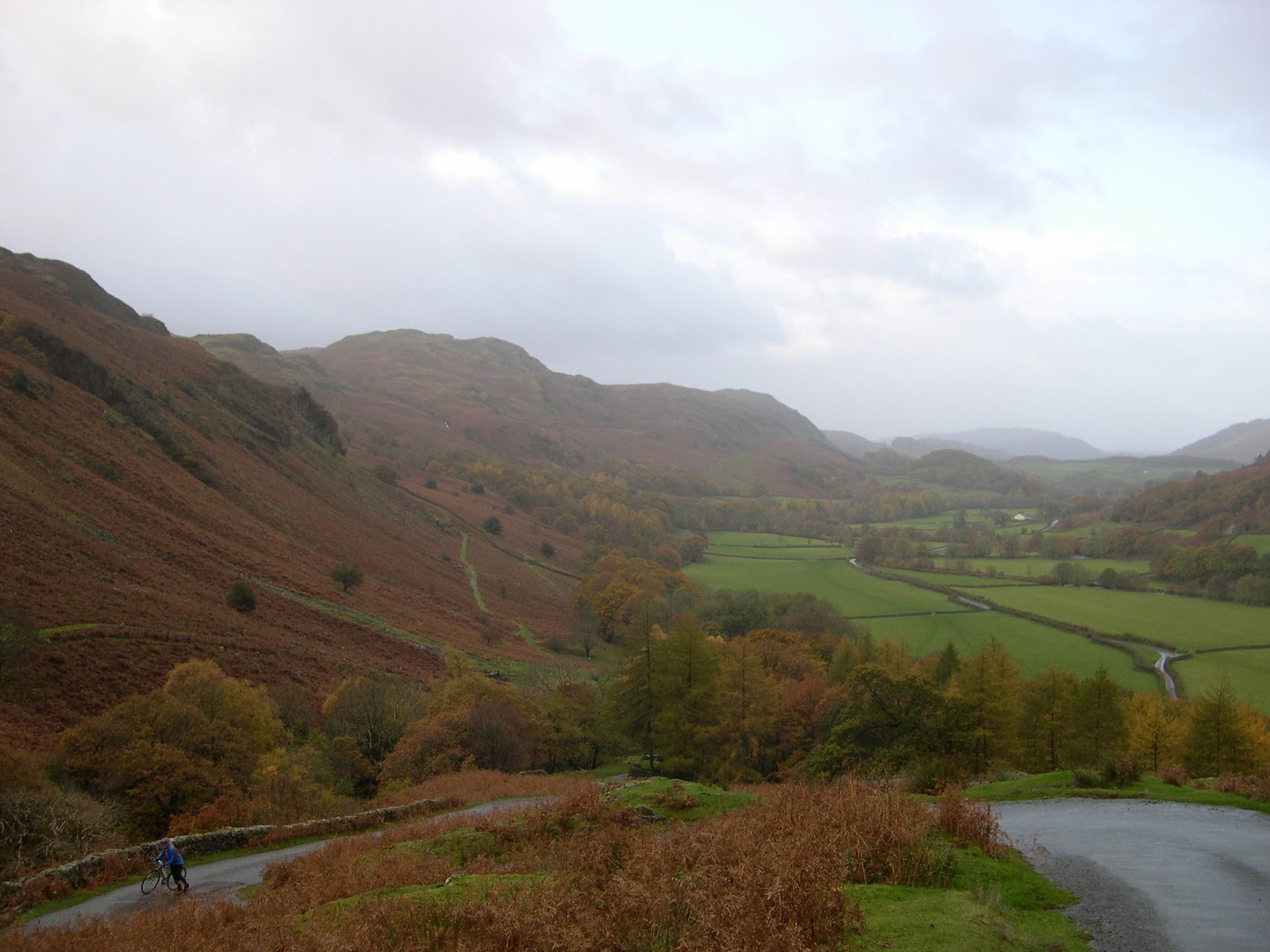
We had a long weekend booked in Withypool, Exmoor so I checked out the book and spotted that there were three climbs within range of where we were staying.

We arrived on the Friday and  I plotted a short 25 mile route, but it took in Winsford Hill, which although not in the book - it was used on the 2009 Tour of Britain which we went to watch so I thought it would be a nice one to judge ourselves on.

I use a Garmin Oregon 300 Handheld GPS Navigator and Memory-Map OS Maps 1:50K - Full GB to plot theses routes and have found them to be totally invaluable. One of those things that you put off buying for ages and then when you finally do get round to buying it, you wish you had done it a year earlier.
The Oregon is not cycling specific but you can add a cadence sensor and heart rate monitor and the large touch screen is perfect for operation on the move. The main benefit is now though, that we don't even take maps out with us (just spare batteries) - we trust the Garmin to that extent - is has been something of a revelation.

Straight out of Withypool though, we hit 20% slopes before our legs had warmed up and although short, this section really was a tough introduction to Exmoor (although much worse was to follow as will become apparent).
As it happened, Winsford Hill was fairly straightforward and we both enjoyed it thoroughly and it may well have led me into a false sense of security, as that evening I set about creating a route to take in two climbs that were in the book - namley Porlock Hill (rated at 9/10) and Exmoor Forest, which is the easiest of the three climbs out of Lynmouth (rated at 3/10).
I set the route to take us fairly directly and with as much flat as possible to Porlock Hill as I didn't want to set off to hard.
I had read the comments in the book about the smell around this famous section of the A39 - the so called steepest "A" road in England and thought that our legs would need to be as fresh as possible to tackle this notorious climb.
The Winsford Hill climb the day before had though, given me a great deal of confidence and we duly arrived at the fork in the road at the bottom of the climb where you can elect to go via the less steep toll road....

The You should Know Better Sign at the Bottom of Porlock Hill

To go up the climb you take the left fork and straight away the road starts to climb to about 7% and narrows to a single lane past some houses, widening again once it has gone past. Looking up at this point you can see a house up on the left on the outside of a right hand hairpin bend and the road has steepened quite a bit without it being too obvious. As you approach the hairpin though, the pitch becomes well over 10% but fortunately you are on the outside of this bend as you can see from this photo....

Porlock Hill - Yes it really is that steep
.... but this though, is nothing compared to what greets you when you get round this corner.

The road rears up to 25% and seems to go on for ever as it heads into the trees - in fact you can't even see the next corner, which is said to far steeper than the first - and you are on the inside of it this time.
I had spend much of the early part of the climb out of the saddle, but my brain quickly told me to sit down, otherwise I would burn out in no time.
As my heart rate hit 175 I sat back in the saddle to try and conserve some energy, but met with something that I had never come across before ...... the road was so steep that my front wheel was starting to come off the road - I had no choice but to stand up!
I got about 200 yards up this section before my bpm was over 180 and I thought, I have got to stop, so quickly unclipping before I fell off I stood gasping at the side of the road and peered over my shoulder to see how Amanda was getting on - she wasn't - already pushing as she rounded the bottom bend (a sight that would become fimilar in the coming months), she shouted "go on, don't wait for me". Hilarious in hindsight as she clearly had no idea that I was really struggling and thought that I was hanging on for her!
I had stopped which is all but accepting defeat, but I decide that I was not going to push even one inch of this hill, so I caught my breath and clipped back in - no mean feat in itself given the extraordinary gradient at this point.

Steady progress seemed to be the best bet from now but, as the second left-hand hairpin approached, this was clearly not going to happen as a truly unbelievable stretch of tarmac came into view. The profile says 25% - it may be in the middle of the road but on the inside of the corner it must be around 70% - so you have to go out into the middle of the road ,which I did , and then carried straight on to the far side of the road to the escape lane for those coming down the hill. Amanda was still walking so I decided to sit tight and wait for her to get to me, which gave me time to take in what was going on around. Cars, campers and the like really struggling to get up this road, and the point in the description about the smell was spot on, the whole place stunk of clutches and brakes - awful.

Amanda duly arrived and after a brief chat I got back on and headed up the next section of super-steep road, then turning gently right it finally started to ease off and became easier to cope with, and so it continued as the hill progressed, ever less steeply to the top, now out of the trees, the fantastic views become apparent and you can really get cracking despite a few "false flats" misleading you to as where the finish really is.

Amanda caught me up quickly and we headed off towards Lynmouth via the steep decent of Countisbury Hill, which once completed lead to a well deserved coffee and rest at one of the many watering holes in this lovely little town.

Back on the bikes, we set off for the Exmoor Forest climb which was a delight. It is a fairly long climb of around 11km but the steady gradient and meandering route along a river keeps your mind on taking in the scenery and by the time you have reached the top of Exmoor, you haven't really had time to feel tired.

I learned a valuable lesson that day - I didn't treat Porlock Hill with the respect that it merited, and it smacked me down for it - I won't do it again.

The weekend finished with heavy rain which forced me to abandon plans to do the 10/10 climb of Dunkery Beacon - which is probably as well as we drove it before going home and I don't think my tyres would have been able to grip the road , due to the amount of surface water.

I plan to come back to meet up with Porlock again and hopefully Dunkery as well.

Saturday 13 November 2010

Cairn O' Mount

I really wanted to cycle whilst in Scotland as I have been there a number of times and never had the chance.
My wife knows the area well as she is half Scottish and has often told me of her lovely holidays there as a child, but there was one thing that she had mentioned to me that had stuck in my mind - Cairn O'Mount, a mountain just north of Brechin, with very steep sections of road which her family had driven up many times when they were children.

I love climbing mountains on my road bike...... I can't exactly say why but I just do. My wife says that it is because they represent such a challenge and I can't resist trying to get the better of them - she may well be correct.

My mind was made up - I wanted to cycle up Cairn O'Mount come rain, wind or shine (or probably just the first two knowing how the Scottish weather can be!).

So on the Thursday morning, myself and Amanda set off on an 80 mile round trip, designed to take in the Cairn, and to visit some relatives along the way. The wind was blowing from the north, so the climb would be directly into the teeth of the wind and this toughened it up making it very hard going. Add to that, the fact that the climb has two very distinct steep sections - 16% right at the start and 14% through a hairpin at the end - making it a formidable proposition. You can see the profile here courtesy of climbbybike.com.

The Profile of Cairn O'Mount
The great thing about climbing on a bike though, is that you see everything that nature has to offer on the way up. Every stream, every waterfall and the birds of prey that are so easy to miss whilst in the car (I am sure that many walkers will also echo these comments). Add to that the feeling when you finallly get to the summit and look at the incredible view knowing that you have really earned the right to soak it all up.

I enjoyed the ride so much that I went and did it again the following day - this time though, the northerly wind was much stronger, no place to hide. Once over the top, I got down the far side and to the bottom I turned round and came back up the north side, which proved to be considerably easier, as the climb is longer and therefore less steep - not to mention the wind helping from this side.

On the decent I hit an unbelievable 53.4 mph, the fastest I have ever been on a bike and beat the car down by about three minutes - totally exhillerating, but don't take my word for it, here's the screen shot from my GPS.....

Please have a look at the video below as Amanda recorded some of the day while she followed in the car.


This short trip had made my mind up - I was going to do everything I could to get place on the Etape Du Tour 2011 and try and raise some money in the process.

Friday 12 November 2010

The Journey Begins

In 2009 I raised over £2300 for Parkinson's UK by cycling from London to Paris, and the following year, my wife raised over £1200 for The Alzheimer's society by cycling "The Hampshire Hilly Hundred".
Being a keen road cyclist, I have watched th Tour De France in awe and thought what a great challenge it would be to ride a stage.
Little did I know that the chance is there, each year in the "Etape Du Tour". Over 10000 amateur cyclists set off on the Tour's most difficult mountain stage, and ride it under the same circumstances as the Pros themselves, (closed roads, banners, huge crowds etc).
This, I thought is just a pipe dream and not anything that I should think too hard about.

That was until I flew up to Scotland on 11th August this year to join my wife and her family for a week's break. She took my Madone ahead in the car and a few days later I jumped on a flight to join her.
Whilst waiting at the airport, I bought a copy of Cycling Weekly to help pass the time and quickly got immersed in an article about the 2010 Etape, written by a lady who had experienced it for the first time herself.
As she spoke about the incredible atmosphere that she encountered, I felt a huge sense of desire to take on the challenge in 2011, although the route was not set to be announced until the back end of October 2010.
I got off the plane and almost instantly announced to my wife that I wanted to do the Etape in 2011 as my 40th Birthday present.