The weather was never likely to be that good so I took the Trek 1.2 and Amanda took her 1.5 WSD and on the Sunday morning we planned a ride so that we could meet my parents in the tea shop at Osbourne House to give them a key and then ride home.
We have done the "Round the Island" route a few times but generally in an anit-clockwise direction so we decided on the clockwise route heading off from Ventnor towards Freshwater, which takes in a couple of nice climbs as the road traces the southern costline.
The second climb is a personal favourite of Amandas as the views are tremendous and the decent is safe and fast.
You can just see the road going over the chalk cliff in the distance.
The top part of the island is fairly flat and a tail-wind meant that we made good time, handed over the keys and headed off to finish the 48 mile ride in good time.
On the following morning (Monday) I decided to get up early to tackle a specific climb - St Lawrence Shute. It probably won't be a surprise to know that my support vehicle chose to stay in bed, but it did not matter as I was only planning a short ride.
This is the view from the main road looking up the first section which leads past the little church on the hillside and the postbox.
This first section is over 8% in parts and represents a good challenge.
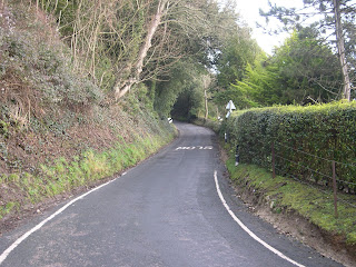
Every hill of note has "that bend" and this is no different. A sharp right hand hairpin and the road goes left and over a small bridge, and then turns sharp right and upto the final very steep section to the top.
This final run to the top is steep but not that long and one thing to bear in mind is that road can be quite slippery as it is under the trees - so rear wheel traction can be an issue.
Once over the top I turned right and back to Ventnor via the top route and a short 20 minute ride was complete.
A nice little climb to try if you are in the area.
I returned back to base camp to join the gang and we all prepared for a walk over Ventnor Down to landslip.
During the walk I noticed that there was a road leading up Ventnor Down to a radar station at the top. It was very steep and windswept but looked like a good challenge.
So myself and Amanda plotted a route to take in the climb as part of short sharp 28 mile run that would take us back through Shanklin and Sandown.
The climb in total from where we were staying is just over 4miles but the last half a mile is virtually flat, as the work is all done by then.
There are a couple of very steep sections of around the 15% mark and the wind on this exposed bit of road makes for an added complication. Amanda did herself proud by making to the top with just one short stop to catch her breath.
Definately worth a go if you are in the area.
This is the steepest section

It has its' own "that Bend" too.
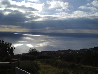
One of the spectacular views looking back over Ventnor


A nice review of of some of the Isle of Wight's best climbs. There is also a very steep climb from Wroxall. Turn off the High Street, onto West st. which becomes Rew Lane, and then up a narrow road to Stenbury Down. The narrow road has a middle section which I have measured approximately to have a gradient of ~25-30% for 25m. Surface is poor in places.
ReplyDeleteOther Good climbs:
- Culver Down (a ramp that very gradually levels out)
- St. George's Lane (steep mid section - nice surface)
- Brading Down (fairly long, but never gets really steep)
- Rowridge Lane (short sharp ramp)
- Skinner's Lane (short ramp - steep stop section)
- Kingates Lane then Crocker Lane. (Fairly long, but never gets really steep. Nice surface on Crocker Lane)
- Newchurch Shute (short ramp)
- Knighton Shute (short ramp - poor surface)
- Newport Shute (one or two steep short sections)
- Bonchurch Shute (flat mid section, ends at a steep junction).
Enjoy!